Storm Forecast Issued: 2010-09-05 21:02:00
Valid: 2010-09-06 00:00:00 - 2010-09-06 23:59:00
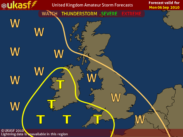
Regions Affected
S Wales, SW England, SW Northern Ireland and Ireland ( England, Wales, Northern Ireland and W Scotland are included in the WATCH )
Synopsis
A large area of Low pressure to the south of Iceland dominates the weather across the United Kingdom on Monday.
Behind a cold front moving erratically northeastwards across the country, an rPm airmass is in place. Steep lapse rates are expected to enable widespread showers and thunderstorms to develop over a good portion of the north Atlantic, and also parts of central and southern Ireland, given enough insolation and cloud clearance from the straddling front.
In any of the showers, given the airmass, hail seems very likely, perhaps up to 3cm in diameter.
Showers should become to confined to coastal parts, and over the north Atlantic, during the evening and night hours, though brisk winds may enable them to travel further inland. The risk of thunderstorms continues into the night.

