BTW, here is an ESTOFEX forecast which has been issued for today, Jun.13:
(...)
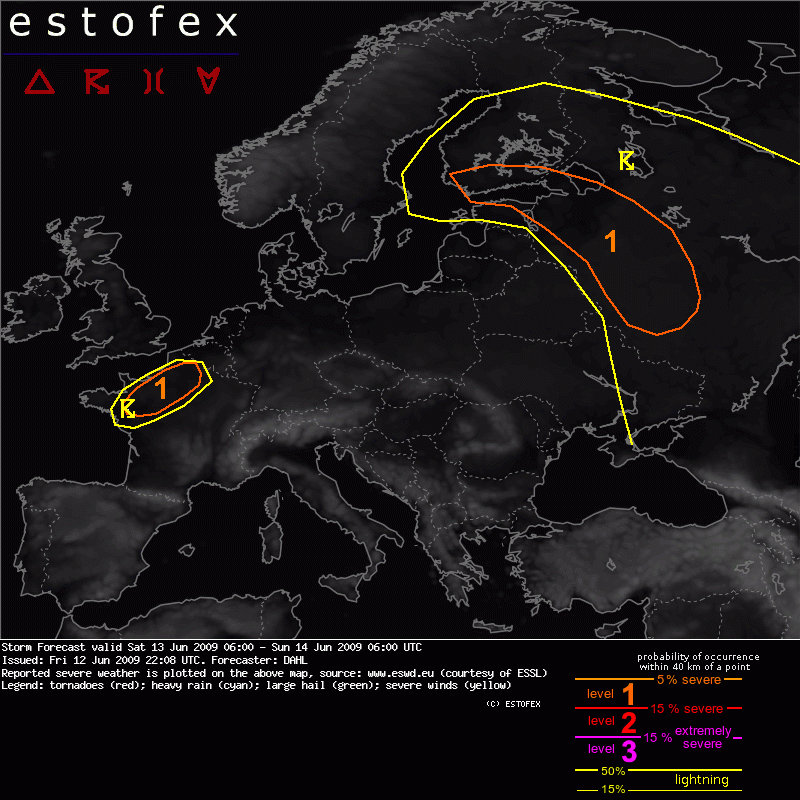
SYNOPSIS
High-amplitude upper flow pattern is developing over Europe, with an upper ridge building over central portions of Europe and two adjacent long-wave troughs over the E Atlantic and over E Europe, respectively. The SFC pattern features two low-pressure systems attendant to the upper troughs and quiescent conditions between these features underneath ther upper ridge over the central parts of Europe. Ahead of the E Atlantic trough, warm and unsstable subtropical air is advected northwards into France.
(...)
It seems that nothing more will occure today after front passage (though there are still t-storms in Kharkiv region, 200 km E from me).
But the storm which occured during the night maybe was close to 'level 1'...

