|
stuart2588
|
guys just had a great thunderstorm pass over Newtownabbey. Have heard reports of very large hail. Had lots of cgs very close by. However I wasnt sure how to capture any on camera. I did however get alot of pics of the storm in general and will post them later.
Storm moving in direction of Larne.
|
|
|
|
|
martinastro
Martin Mc Kenna
Global Moderator
Hero Member

Posts: 5182
Maghera, N. Ireland


|
Great stuff Stuart, and thanks for the report!.
Radar has intensified below Lough Neagh again as well. Nothing of signifigance further W and N though.
|
|
|
|
martinastro
Martin Mc Kenna
Global Moderator
Hero Member
Posts: 5182
Maghera, N. Ireland
|
At least one storm crossing the Irish Sea. Maybe Paul has seen it. Strong radar echoes/poss storms in SE N. Ireland moving NE.
All quite on the western front...again!
|
|
|
|
martinastro
Martin Mc Kenna
Global Moderator
Hero Member
Posts: 5182
Maghera, N. Ireland
|
Today's lightning so far...  |
|
|
|
martinastro
Martin Mc Kenna
Global Moderator
Hero Member
Posts: 5182
Maghera, N. Ireland
|
John reporting thunder from Maghaberry.
|
|
|
|
|
scott86
|
Hi folks, intense rain, sizeable hail and some lovely lightning over the belfast area today! constantly nipping outside of work to get a look, first decent storm ive seen in ages, was well worth the wait!!!
|
|
|
|
|
|
stuart2588
|
Just back from a driving lesson and saw a few c gs over Glengormley. This really has been a great day down here. Here are some pics I took earlier. The storm was moving from right to left in the pic. 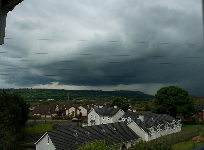 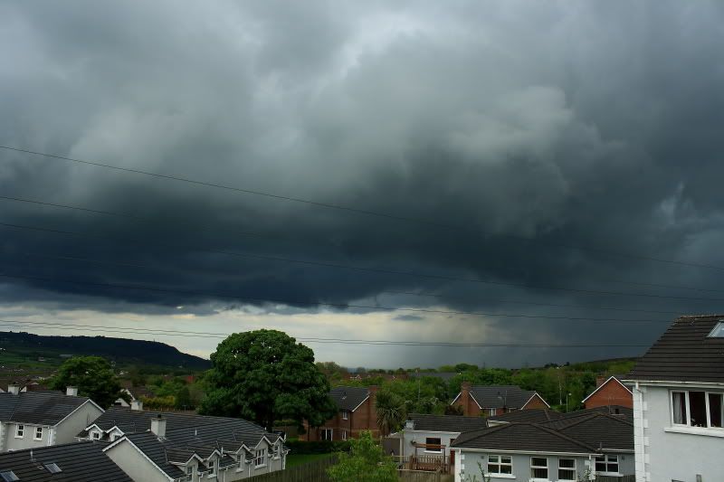 This last one was taken just before there was a really bright cg that came down somewhere behind that house. 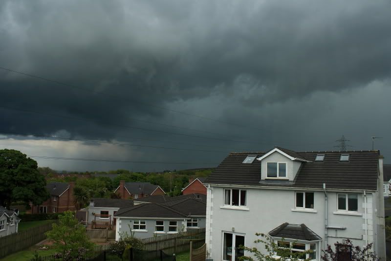 It almost looks a greeny colour. There was also alot of hail reported from the direction of the storm. My house must have been right on the edge of it as we didnt even get a drop of rain. |
|
|
|
|
|
brianb
|
Not done much here, threatening cloud all afternoon but only a couple of very light showers.
|
|
|
|
|
martinastro
Martin Mc Kenna
Global Moderator
Hero Member
Posts: 5182
Maghera, N. Ireland
|
Those are great Stuart!, nice angry structure. Thanks for sharing those images. I'm glad you had a good day of action. Hopefully more on Thurs.
Thunder, Maghera, after 20.00.
|
|
|
|
martinastro
Martin Mc Kenna
Global Moderator
Hero Member
Posts: 5182
Maghera, N. Ireland
|
Outlook for Thurs...  Storm Forecast Issued: 2009-05-20 20:05:00 Valid: 2009-05-21 00:00:00 - 2009-05-21 23:59:00 Regions Affected Northern Ireland, East Midlands, Yorkshire, counties bordering The Wash and Northern, Eastern & Southern Scotland (all of the UK, excluding the south coast, is included in the WATCH region) Synopsis Showers are expected to develop widely across Northern Ireland, Scotland, and central & northern England during Thursday, in response to daytime heating. Thunderstorms are also likely to develop - the most favoured region based on current data is northeast Scotland, where storms may cluster during the afternoon and evening hours. Thunderstorms are also forecast across parts of Northern Ireland, eastern parts of Ireland and also perhaps eastern parts of England. Surface based storms may develop, which may produce a funnel or weak tornado. Hail and gusty winds are likely to accompany many of the showers, and torrential downpours combined with light winds may result with local flooding due to the persistence of the showers. Showers and storms are forecast to rapidly decrease in coverage during the evening, although they may persist for some time across eastern Scotland in particular during the evening. |
|
|
|
martinastro
Martin Mc Kenna
Global Moderator
Hero Member
Posts: 5182
Maghera, N. Ireland
|
Connla Young just sent me over an image of a possible funnel cloud captured at 7pm from Co. Antrim in the direction of Toome which formed at the rear of a strong shower.
|
|
|
|
John9929
Global Moderator
Hero Member
Posts: 1105
Maghaberry, N.Ireland.
|
Nice images there. Had a good afternoon here as well, one big thunder storm produced at least 6 good sparks but the rain and hail was something different. At teatime I had another great big shower and when it passed I had this beautie of a double rainbow. My brother was about 1.5 miles away and rang me as soon as he got home to inform me that he had seen a hint of a third bow, which I think might be rare. The rainbow image was taken with a new fisheye conversion lens I have acquired, but to see me out under a brolly taking images would have been a picture in intself. The neighbors must think I've flipped   The floods from the thunder storm taken through the front window.  |
|
|
|
« Last Edit: May 21, 2009, 02:09:09 am by John9929 »
|
Report Spam
 Logged
|
John9929.
|
|
|
|
stuart2588
|
Those are great. Keep them comming. Will be interesting to see how today goes. Temp in my back garden this morning at 830am was just a shade over 14.5C. Hopefully that will provide some good solar heating.
|
|
|
|
|
|
Steveo74
|
Great shots Stuart & John!!!! John, The fisheye really shows of the rainbow... |
|
|
|
martinastro
Martin Mc Kenna
Global Moderator
Hero Member
Posts: 5182
Maghera, N. Ireland
|
Lovely shots John, That's a great fish eye. Those three bows are extremely rare!!
Warning out from Met Office for Co. Antrim and Co. Down AGAIN...
Scattered heavy thundery downpours will develop again this afternoon, lasting into early evening. The showers could give localised accumulations of 15mm in a 3 hour period.
The public are advised to take extra care and refer to Traffic Watch (NI) for further advice on road conditions.
Issued at: 1028 Thu 21 May
|
|
|
|
|
|
|

